Everest base camp… fundraising etc…
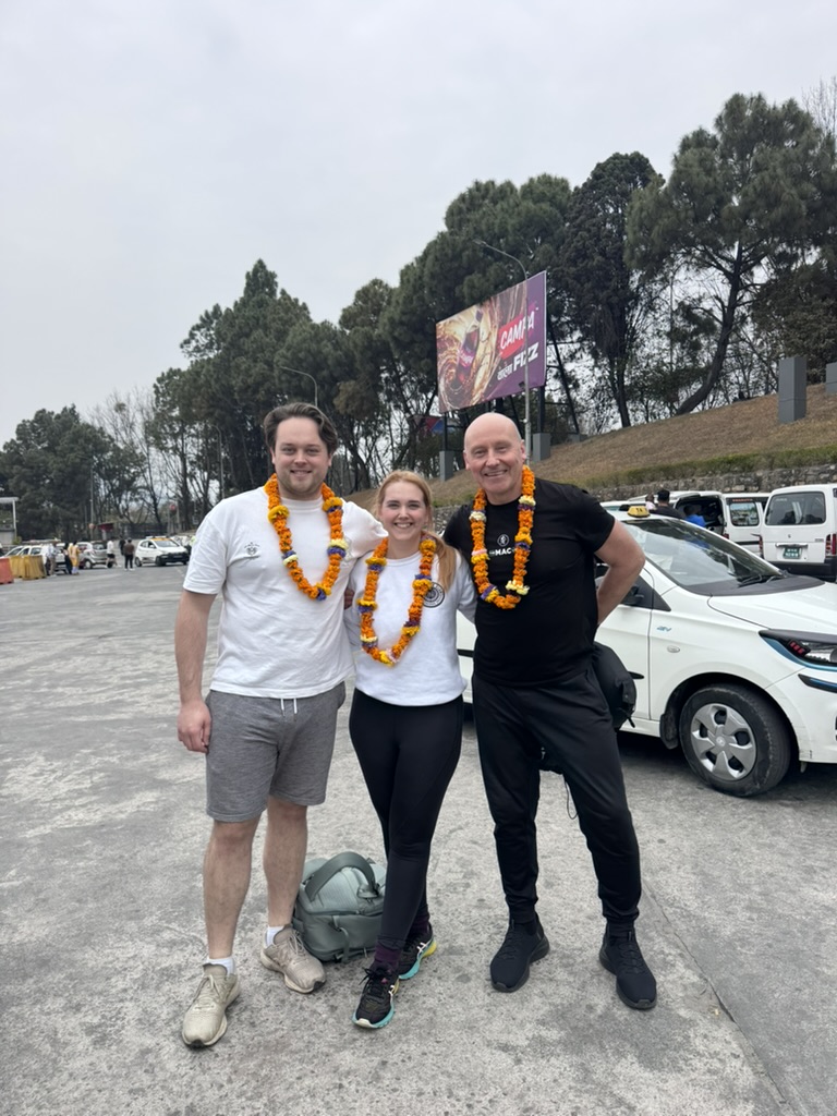
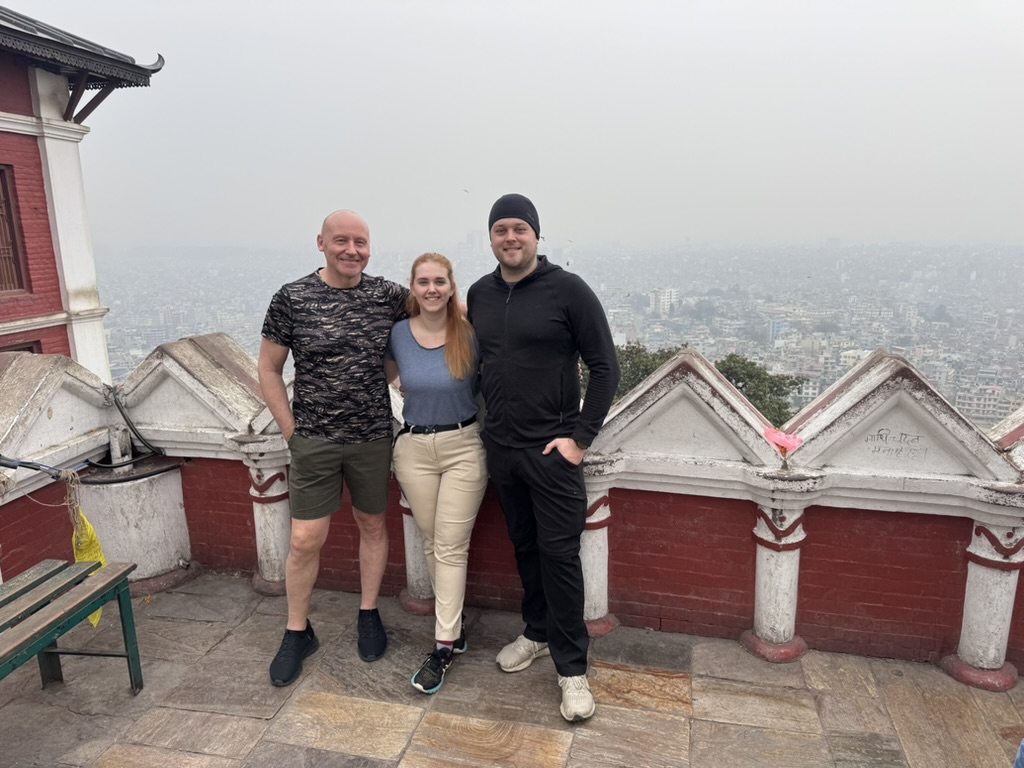
Day 0 – Kathmandu
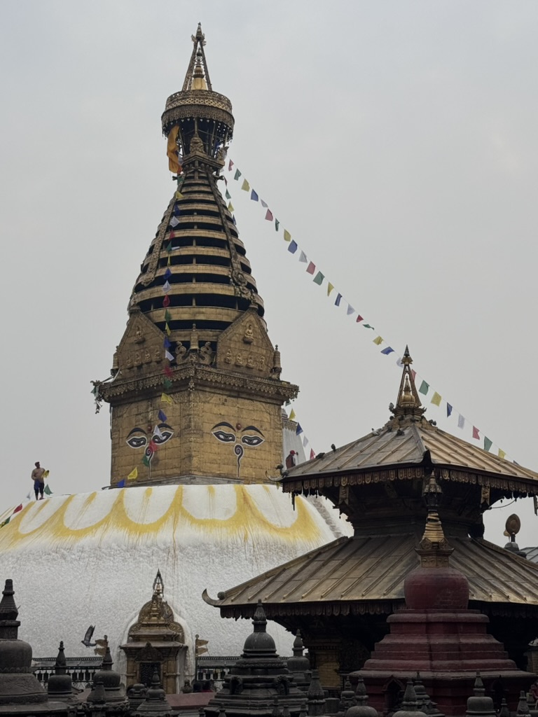
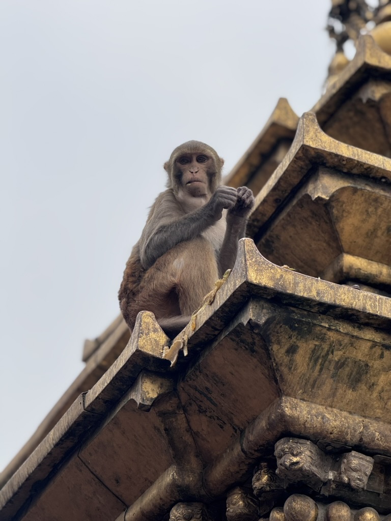
First, the Swayambhunath temple, or commonly known as the “monkey temple”. I think the photos speak for themselves on this one…
Before our trek start, we’ve had a great day exploring Kathmandu.
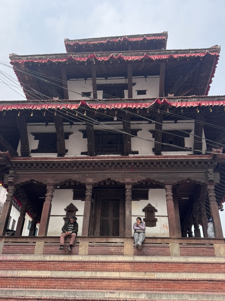
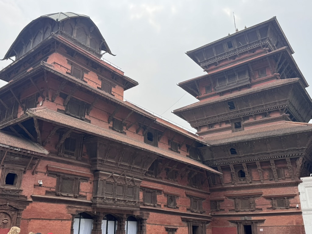
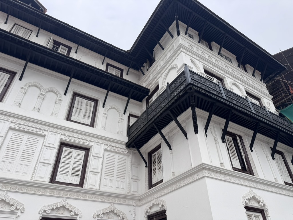
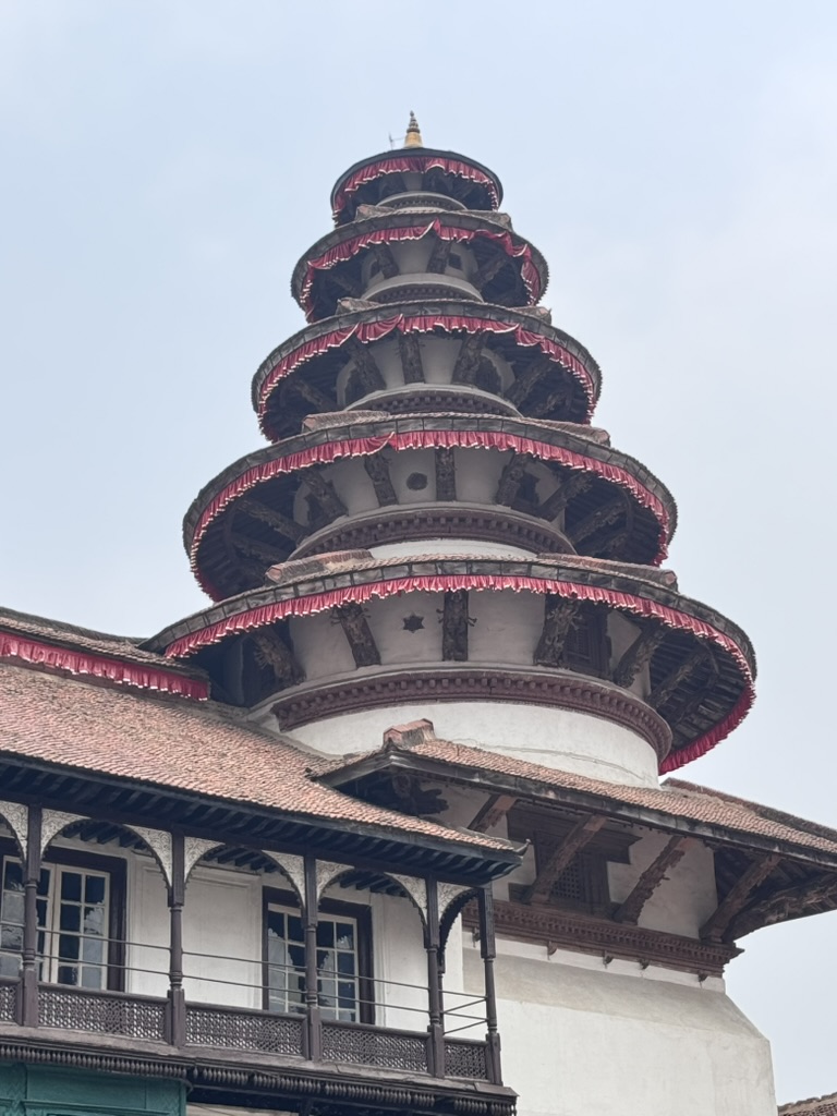
Next stop on our Kathmandu tour was Durbar Square, home to many temples dedicated to the gods.
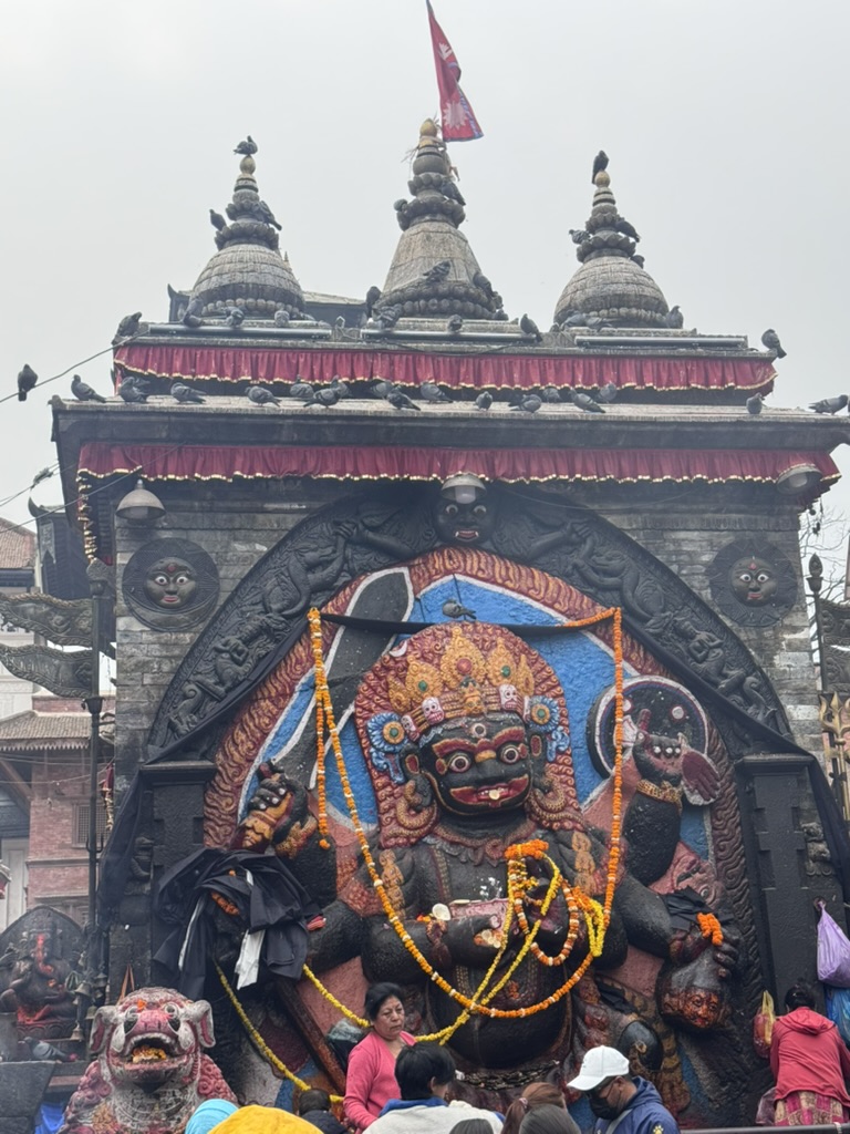
There is a giant temple for Durga, the goddess of female empowerment and protection. It is normally closed to the public and only opens once a year during a festival, where sacrifices are made in honour of the goddess.
A royal palace, with a statue of Hanuman, the monkey god known for strength, loyalty and devotion. The statue stands at the entrance to the palace.
There are depictions of Shiva, the god of destruction. People worship Shiva as a powerful protector.
There is a temple for Vishnu, which is one of the oldest in the square, dating back to the 16th century.
We also got to see an appearance of Kumari, the living goddess. A young girl who is believed to embody the goddess Durga. She lives in the Kumari House in the square and occasionally appears at a window to bless visitors. Photos were not allowed to be taken of her.
The visit highlighted just how spiritual the people of Nepal are.
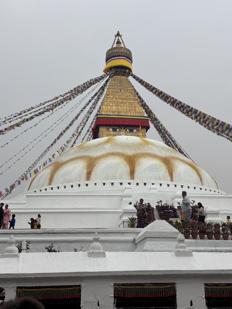
Our final stop of our Kathmandu tour was the very famous Boudhanath Stupa. The stupa is around 2,000 years old, and people travel from all over the world to visit, including the Dalai Lama.
We walked clockwise around the Stupa, as Buddhists do, whilst learning a few facts.
The Buddha eyes represent being watched over for karma and the top of the stupa shows the levels of meditation needed to reach enlightenment.
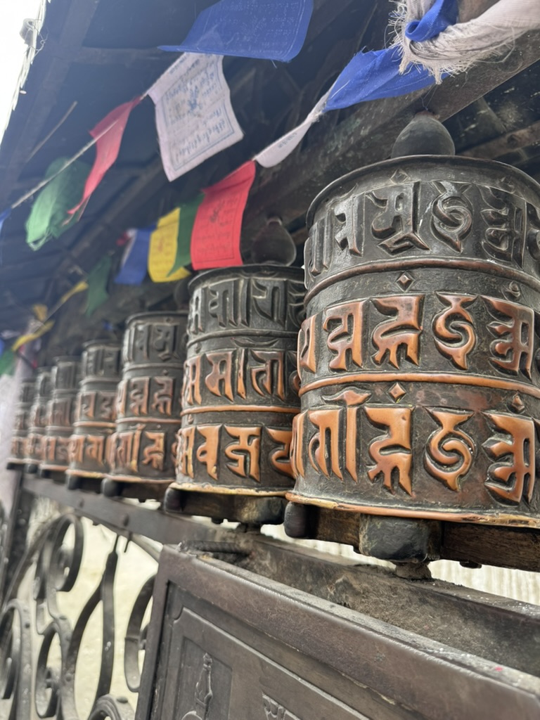
We watched people with prayer beads and spun prayer wheels for good luck. Prayer flags for earth, water, fire and other elements flutter in the wind, spreading blessings. We walked around three times, as our guide suggested.
The numbers 1, 3, 7, 54, 108 are recommended by Buddhists are they are very spiritual numbers, representing things like balance and astronomical symbolism.
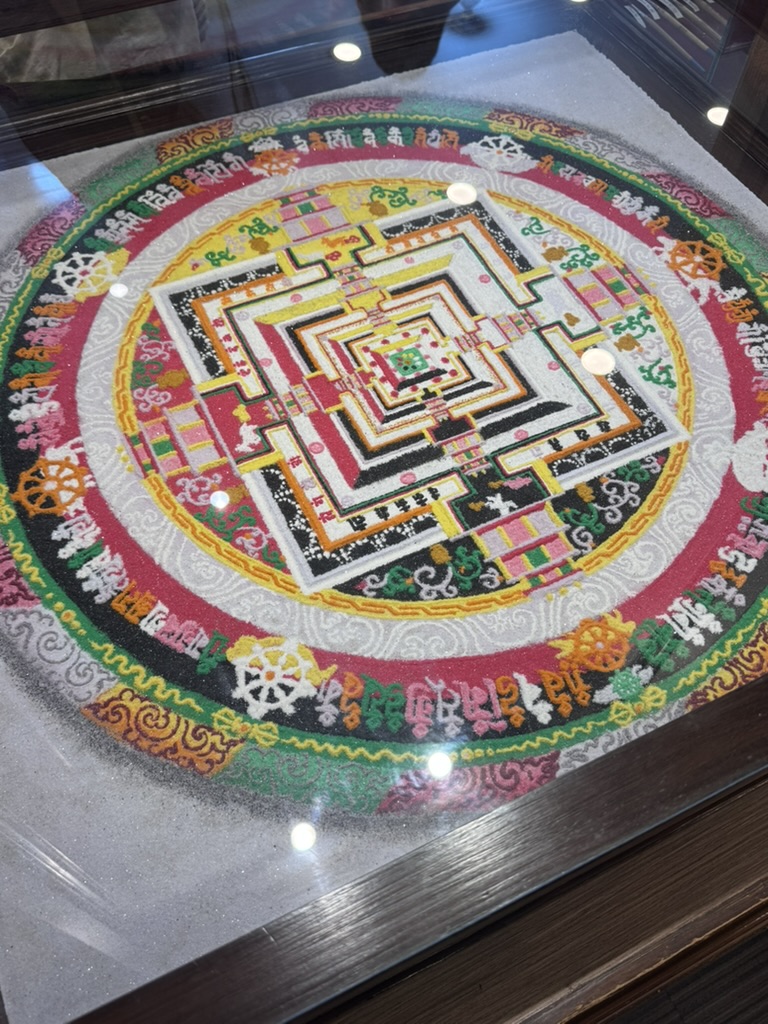
We also visited an art gallery with mandala patterns made from natural rock and metal sands. One mandala shows a bird’s-eye view of the stupa. Lots of Mandela paintings in the gallery take a very long time to create, which was amazing to see!
We finished with lunch overlooking the square and a lovely latte – making the most of little luxuries whilst I can!
Day 1 – Kathmandu to Lukla Attempt
So sometimes in the mountains, things don’t always go to plan… we were supposed to start our trek today with a flight from Kathmandu to Lukla. We were up and at the airport at 5am, ready and waiting.
Lukla is known as one of the most dangerous airports in the world due to being surrounded by the mountains. Unfortunately, the weather didn’t want to cooperate today. It went from mildly cloudy in Lukla to zero visibility.
After 7 hours of waiting in the airport, hoping for the weather to clear, the air traffic controllers decided that flying into Lukla today would be unsafe. All of the airlines cancelled their flights and we had to travel back to the hotel.
We trust the opinions of our guides and mountain experts, so this outcome was for the best. It won’t be the end of our trek – we’re going to be back at it early tomorrow to see if we can catch a clear window.
Day 2 – Kathmandu to Lukla to Phakding
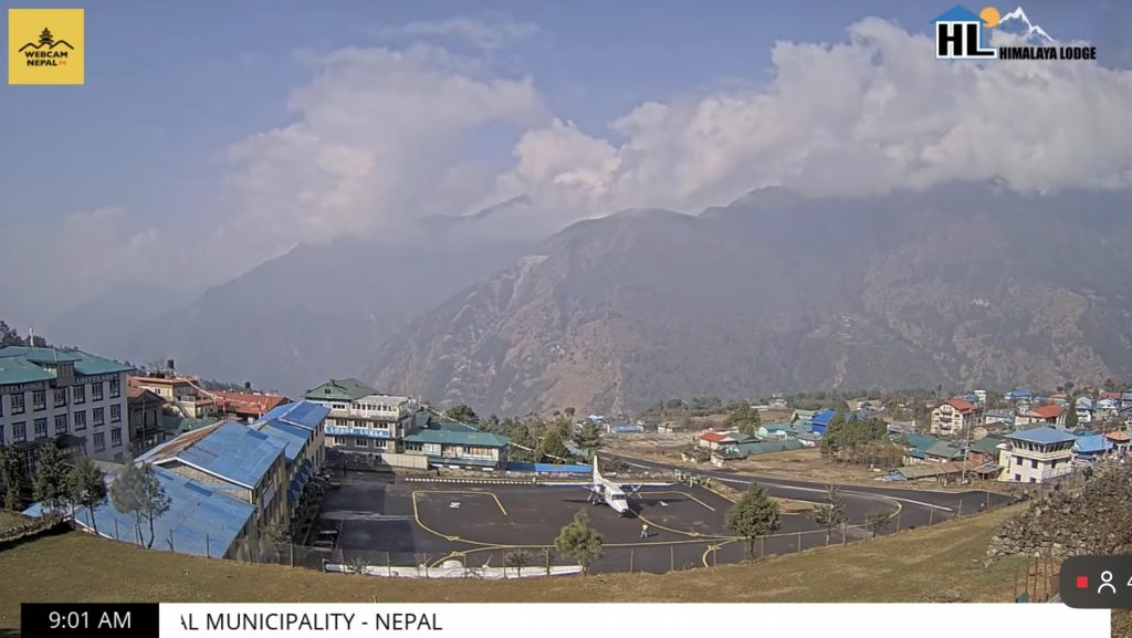
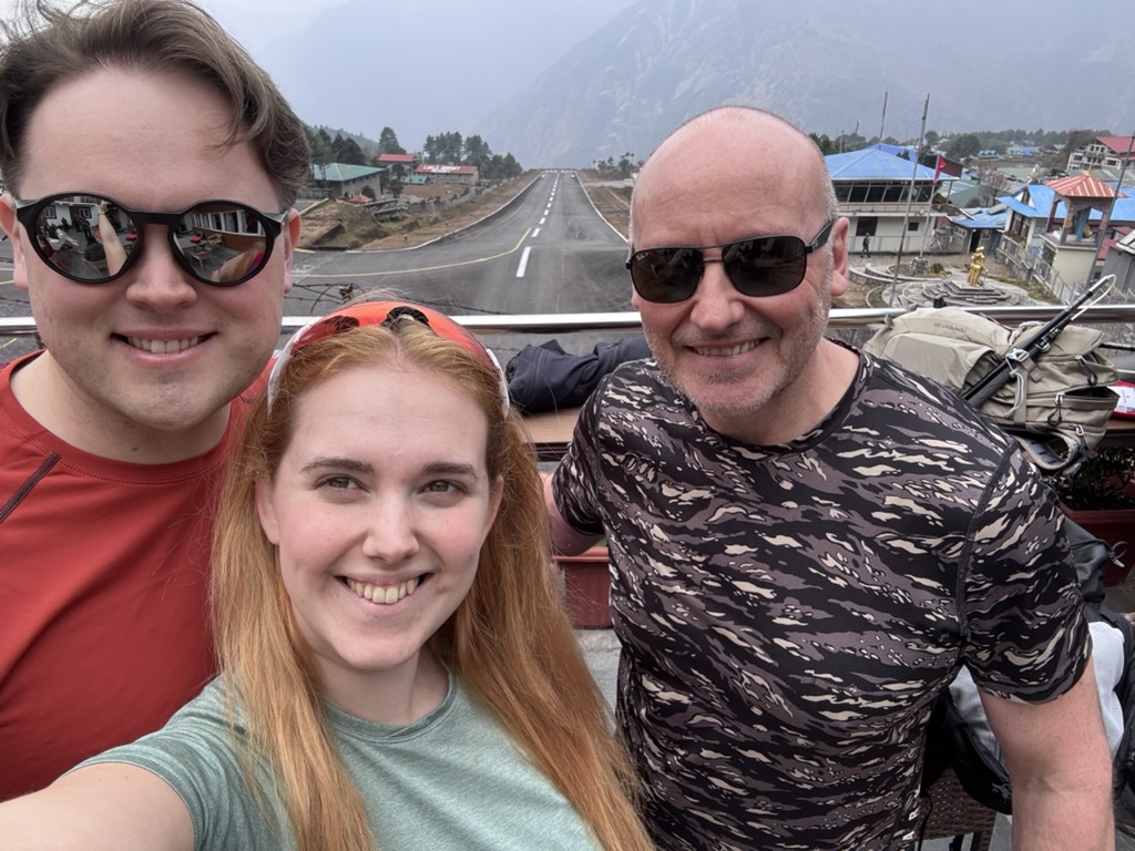
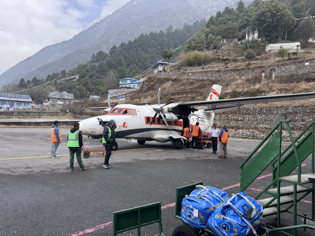
After a couple of hours at the airport today, we finally managed to get clear enough weather to fly out to Lukla. The flight was on a fairly small plane and took approximately 35 minutes. Our pilot had clearly done it a lot because we had a mostly smooth flight and landing.
We had lunch overlooking the (very short!!) runway and watched a few planes go out.
Today was a Nice walk from Lukla to Phakding, approximately 9km, mostly downhill.
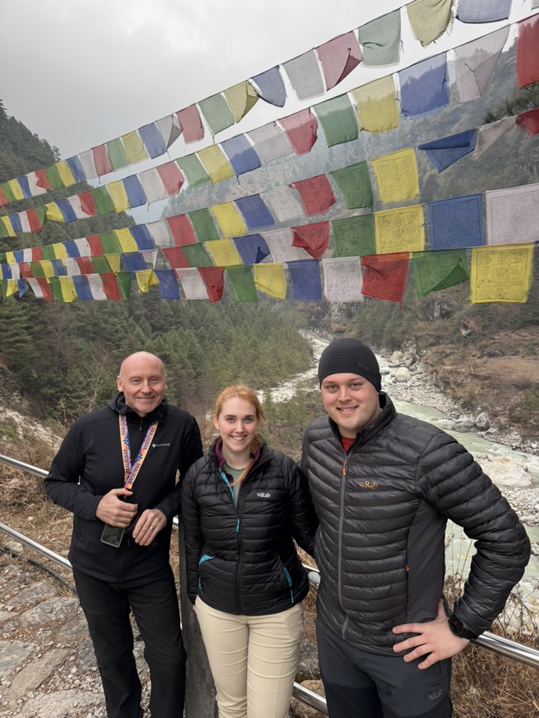
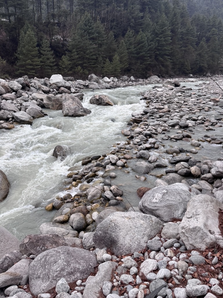
On the walk, we saw a lovely gorge and river, as well as multiple suspension bridges! We got our first experience on one of these, and there are many more to come…
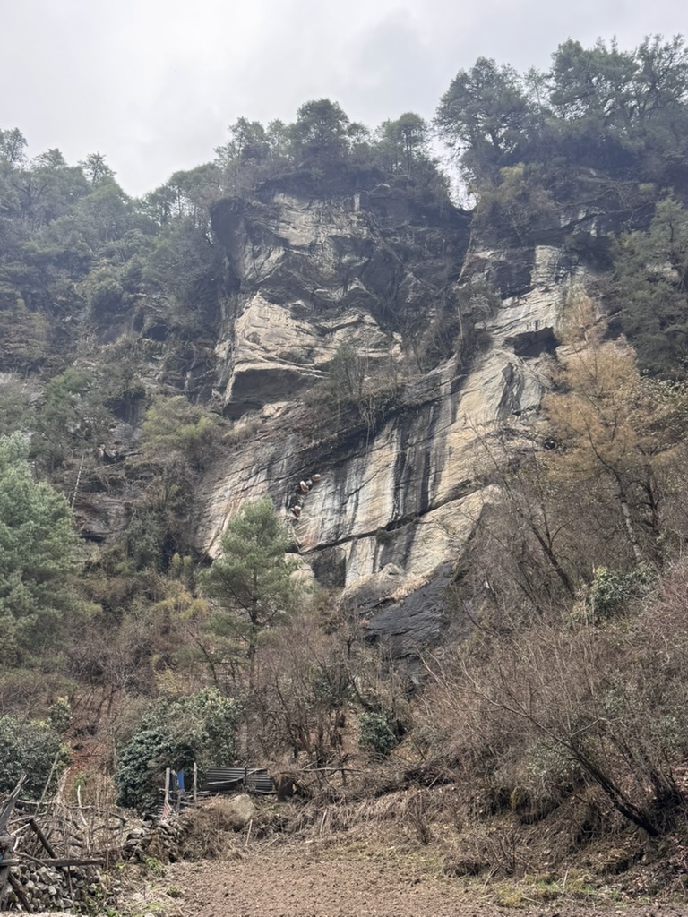
We also saw some natural bee hives full of honey on the side of a rock face, which was really interesting. People in Nepal will often climb to harvest these after the bees leave.
We’ve reached our tea house now and are enjoying some well earned biscuits and tea.
We’re currently at an altitude of 2680m, which is actually lower than Lukla airport, so we have plenty of climbing to do tomorrow.

Day 3 – Phakding to Namche Bazaar
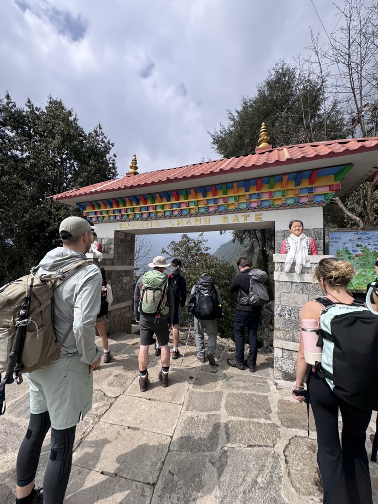
Today was a very tough hike up to Namche Bazaar. We started out in the morning in Phakding and walked for a few km to reach the national park gate entry.
We had some glorious sunshine today, which was refreshing after the clouds of the past few days in Kathmandu and Lukla.
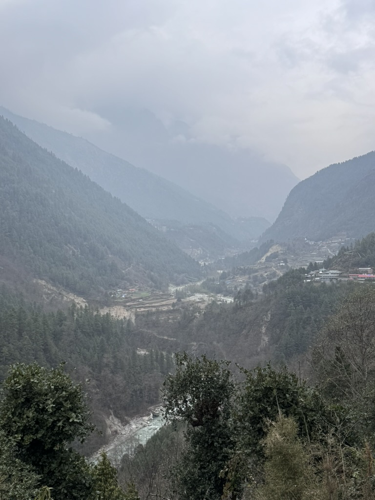
On the way, we crossed the river a couple of times and wove through some beautiful scenery, whilst climbing about 200m in elevation.
After entering the national park, we descended about 200m – basically all of our progress…
It’s okay though, we were rewarded with some lunch! We had a lovely lunch in the last village before reaching Namche. We discovered that they grow garlic and potatoes fresh here, which made the meal taste even better. We also managed to catch some Yaks walking across the suspension bridge nearby, they didn’t seem impressed by it.
There are lots of yaks and donkeys on the trail. These animals are used to transport all goods into the national park. For many villages in the area, this is the only way to receive supplies.
After eating a delicious lunch, we headed back into the trail. This is where it got pretty tough. The views were incredible as we reached the Hillary bridge, sitting at 3140m elevation. It sits 135m above the river bed below.
The climb got quite difficult, with lots of stairs and some very uneven terrain. We also had to venture into the forest because part of the road was still being constructed! I have major levels of respect for the builders, they carry all the rocks up from a quarry lower down on their backs.
We continued climbing, with quite a few snack and drink and sometimes just breathing breaks. We finally made it to Namche Bazaar at about 3pm after 11.35km and 800m of elevation. We got to our tea house just as the clouds started to move in again. Unfortunately, the photos don’t quite do the trek justice.
Very pleased with our progress today, although tough, it was a very enjoyable hike. Tomorrow we have a “rest” day, where we’ll venture out for some acclimatisation.
Day 4 – Namche Bazaar Acclimatisation
So it turns out that English “rest days” and Nepali “rest days” are two vastly different things…
Today we hiked up to our highest elevation yet of 3880m. The climb was very steep in parts, with lots and lots of stairs. We went through steep rocky paths and terrain.
Although a short walk, it was pretty tough on our tired legs, but something we definitely needed to do.
We were blessed with glorious sunshine in the morning, meaning that we got our first view of the Everest Peak. This definitely made the walk worthwhile!
In the photo, you’ll see Everest, at a height of 8848m. It’s joined by other significant mountains Ama Dablam, with its very significant shape at 6812m and Lhotse at 8516m.
The scenery was breathtaking, and photos truly don’t do it justice.
On the way, we stopped off at the Sherpa Museum. It’s amazing to read about how these Sherpas have adapted to these mountains and their harsh conditions. Their way of life and resilience is truly inspiring. After countless years of failed attempts, Everest was finally summited in May 1953 by a Sherpa called Tenzing Norgay. He was joined by Edmund Hilary, the namesake of the Hillary suspension bridge.
It was great to learn about the history and reading about the techniques used. I have a lot of respect for all the people who attempt Everest, it’s not for the faint hearted!
We managed to reach the Everest view point and take some pictures just in time before the cloud started to move in again. After that, we layered up and headed back down for some well earned lunch.
Day 5 – Namche Bazaar to Tyangboche
Today we set off to Tyangboche from Namche Bazaar. The walk started with some delightful, steep stairs which we were all thrilled about obviously…
After about an hour, the trail flattened off, much to our relief! We were also blessed with some glorious sunshine today. It was so hot, that the lucky amongst us even got some sunburn (me included!) despite wearing factor 50.
Along the route, we again saw prayer wheels and stupas. This whole trail reinforces how deep Buddhism is embedded into Nepali culture.
For a couple of hours, we walked along a swinging, but fairly flat path with the most phenomenal views of the trip so far. Being surrounded by both woodland and mountains is just incredible. I don’t think the photos quite do it justice.
Along the trek, we were accompanied by Everest, Lhotse and Ama Dablam.
After lunch, we started the real work. A 600m climb in the sun. Lots more large stairs and rocky trails. Although the sun provided beautiful views, it made it a very difficult climb.
Reaching Tyangboche at the top was a wonderful feeling. It made for our highest altitude at 3860m. The Nepalese continue to amaze me, because at the top is a beautiful monastery. It’s carved very intricately and painted in beautiful bright colours. To build something so grand at this altitude is just incredible resilience and craftsmanship.
Our guides decided to take us down for 20 minutes into Deboche, to sleep about 100m lower than Tyangboche. Apparently this makes acclimatisation easier.
Just as we were about to head down, a herd of Chauri rose up before us. It was quite an intimidating sight! Chauri are a cross between a cow and a yak. Apparently, yaks cannot go lower than Namche Bazaar due to the altitude and increasing temperate. Therefore, to be able to travel further, they have been bred to have shorter fur, like cows.
After making sure we weren’t trampled, we headed down to Deboche and were treated to a warm log fire in our Teahouse.
Day 6 – Tyangboche to Dingboche
Today we set off to Dingboche. Again, we were blessed with glorious sunshine, which was good for people’s spirits, but not so much for our sunburn…
After about 25 minutes of walking through more scenic views, we reached another suspension bridge, and a pretty big one too!
We stopped to take a photo as a group, but had to be quick because a large train of yaks were wanting to pass through.
The trail today was fairly mild compared to some of the steep climbs that we’ve had. The trail was slow inclines and flats, with a few sets of stairs. It was a refreshing change from some of the large, continuous steps that we’ve had to do in previous days.
However, today was our last sighting of Everest for a while. As we get closer, it disappears behind a ridge. We still got some beautiful sights of Lhotse and Ama Dablam though.
After a very sunny lunch, we started to head higher. The terrain turned into more of what I expected initially. Trees started to disappear, leaving only small bushes and shrubs.
The path became a little less defined and more of a barren track as we neared Dingboche. Additionally, the sun started to disappear behind clouds and the temperature rapidly dropped. It started to snow about 15 minutes before we reached our teahouse.
After having some tea and a short rest, we decided to venture out into Dingboche to explore. This meant kitting up properly, because by this point, it was snowing heavily and the temperature had dropped to about -5°C.
Safe to say, we didn’t spend too much time outside!
Day 7 – Dingboche Acclimatisation
We had another day of Nepali resting today, which of course meant pushing ourselves to the limit by climbing up to a ridge.
Whilst previously, we’ve had nice defined trails to follow, today we had no real path. Instead, we spent a couple of hours traversing across the side of the mountain very slowly. At this altitude, the air feels very thin, so we’re breathing a lot more frequently and struggling to get enough air. You definitely start to feel it a lot more!
We started at about 4410m in Dingboche, and hiked up to about 4850m. It was one of the toughest climbs yet, made even more challenging by the snow last night. This made the trail quite slippy. We were very thankful to have our walking poles to steady us!
Whilst up on the ridge, we could see so many mountains! Our guide was talking us through all the different ones, including Makalu and Cho Oyu. These are the 5th and 6th highest mountains in the world.
In the photos, our guide in orange is pointing to a glacier. It doesn’t look much like a glacier currently as it’s covered in scree and dirt from rockfall. However, it is still active and sits above a frozen lake.
From this elevation, the village below looked very small. Hiking up here and back down will allow our bodies to get used to the lower oxygen levels. Most of us started to feel some altitude effects of mild headaches and shortness of breath. Hopefully tomorrow, our bodies will have adjusted and we’ll cope better.
Although sunny in the morning, the temperature has definitely dropped, and we all layered up for the walk down. By the time we reached our teahouse, it was starting to snow again. The rest of the day was ours to enjoy.
After having some lunch, we ventured out into the snow to explore Dingboche. We walked through the main street and stocked up on some goodies (mainly chocolate) in the shops before heading to a cafe.
Cafe 4410 exceeded all of our expectations. It’s decorated beautifully and serves the best food. At this point, we’ve eaten so much rice, noodles and potatoes to last a lifetime and are starting to get very sick of them…
The food here is honestly amazing. Pizza, hot chocolate and brownies do wonders for morale! To be able to get this quality of food at such a high elevation is truly amazing. Bonus points because it was cosy and warm inside, despite the growing blizzard outside.
Day 9 – Dingboche to Lobuche
We set off today from Dingboche (4410m) to head towards Lobuche (4910m), which is officially our last night before heading to Everest Base Camp! Wow, the time has flown by!
It was about -13°C when we set off this morning, despite the sunshine. Much colder than previous days.
We set off using the same trail as yesterday, traversing across the mountainside, but luckily only for 30 minutes or so before we split off along a separate path.
I’m aware that I keep saying that the views are amazing every single day, but they truly do keep getting better and better. The photos don’t quite do it justice!
We spent the best part of 2 hours walking through a winter wonderland. The snow was beautiful and the mountains were very clear due to blue skies and sunshine.
We passed a small area that looked like a half-built village. According to our guides, for one month every year, the people of Dingboche vacate the village during monsoon to this little settlement. for religious reasons, they’re not allowed to light fires within the village, so have to do all of their cooking out here. Some choose to sleep here, whilst some make the journey back to the village after cooking and eating every day. I’m guessing the buildings with roofs belong to the families who sleep there, otherwise they might get quite wet!
After stopping for some lunch, we headed back out. This time, the sun had disappeared, making it a whole lot colder. The mountains also looked more ominous surrounded by clouds.
After about a 45 minute climb, we reached the Everest memorial. There are lots of memorials, plaques and rock towers here dedicated to all of the people who have sadly lost their lives attempting to summit. It was a sad sight to see so many, but a lovely way of remembering these brave people. By reading a few plaques, it was clear that they were all loved very much by their families.
About an hour later, we arrived in the small village of Loboche. At this altitude, every step needs a dedicated breath and even small movements become more difficult. Our pace has definitely slowed right down. We will be spending the afternoon resting and eating plenty of food to refuel before our final push tomorrow. By lunch time tomorrow, we should cross the 5000m elevation mark and reach Gorak Shep (5170m), before continuing on to base camp (5364m) in the afternoon.
See you tomorrow!
Day 10 – Lobuche to Gorakshep
This morning, we set out from Lobuche at 6:30am in temperatures of -18°C, ready for a very long day. Lobuche sits at 4900m, our destination of Gorak Shep sits at 5100m.
We started by walking through a lovely expanse of flat snowy ground, surrounded by mountains. It was a little cold, but a beautifully scenic walk.
We also came across more yaks and chauri. According to our guide, they were returning from Base Camp after carrying supplies. The climbing season starts properly in April, but there’s a lot of preparation work that needs to go into Base Camp before it can be used. This includes tents, beds, cooking equipment, gas bottles etc.
We started to climb higher and the sun came out, so atleast it got a lot warmer. The climb became quite difficult as we surpassed 5000m of elevation. Additionally, the cold weather and snow made the trails incredibly slippy. Some of the paths were very steep, rocky and icy. We even had a few slips, trips and falls… myself included 😅
At around 11am, we finally reached Gorak Shep, our last stop before Base Camp! We sat down for some lunch and a quick kit reorganise before the final stretch.
Day 10 – Everest Base Camp
It was finally time!!
After some lunch in Gorak Shep, we headed back out into the snow. The walk to Base Camp was a mix of ascent and descent with some flats, totalling an overall ascent of 250m.
The trail was similar to our morning route to Gorak Shep, very icy, rocky and not easy to walk on. Even on flats, we were very slow and picking our foot placement very carefully.
On the way, we saw some more yaks but also porters. Human porters are also used to carry supplies and we’ve actually seen quite a few porters carrying large wooden bed frames! They’re incredibly strong.
We walked for a couple of hours before finally seeing a few tents already set up in base camp. Although there are no climbers on Everest currently, there are a few Sherpa groups already up there setting the fixed lines and ladders. I imagine this takes an immense amount of skill and bravery.
We soon saw the rock that marked Everest Base Camp and began a short, icy descent towards it.
The feeling is almost indescribable. To have prepared for something for over a year and trained almost as long, all the planning and logistics, especially with our flight nightmares! The feeling to reach Base Camp finally was amazing, such joy and relief.
We’re all very proud of ourselves. I’m so glad that I proved to myself that I’m capable of completing such a challenge. Anyone who spoke to me beforehand would have known that I certainly had my doubts!
We’re so pleased to have reached our goal.
I’d just like to do a shoutout for our guides too. Our lead guide Bibek has been incredibly knowledgeable of history, culture, geography and of course the mountains! Bal has led our walks most of the time, with a steady pace and lots of motivation. He also has provided great jokes and a few songs for our entertainment. Bhuwan has been in the middle of our group with all of our backup stuff like first aid kits and water.
Our guides have been fantastic, looking after us very well. Our porters have been very quick, with our bags often arriving before us! We genuinely couldn’t have asked for a better team to support us through this trek.
Day 11 – Kala Patthar
The day after reaching base camp (), we were up early again for another long day.
We left Gorak Shep (5100m) at 5:30am in -24°C ready to attempt Kala Patthar. Kala Patthar is a viewpoint sitting at around 5545m. It’s fairly popular for sunrise views of Everest’s peak. However, it’s a very difficult climb, made even harder by the cold temperatures, lack of sleep, altitude and lack of oxygen.
We started out mostly in darkness with head torches, trekking through the snow and up a steep, rocky ascent. After about 40 minutes, Everest’s peak started to become visible above the other mountains. With the soft glow of sunrise behind it, the sight was truly breathtaking.
We continued on through the snow. Each step was difficult, requiring much more frequent breaths and rests. At this temperature, our water bottles and hydration bladders had actually frozen, so we had very limited access to water, making the trek quite uncomfortable.
Unfortunately for me, I started to feel the altitude quite badly. After numerous days of trekking, poor sleep, loss of appetite, my body didn’t seem to want to continue and I was beginning to feel very ill. I sadly had to turn back at about 100m below the summit. Whilst this seems very close, in reality the summit was still nearly an hours walk away and I just couldn’t go on any further.
The rest of the group, including Matt and Gary, continued through the ice, snow and rocky terrain before finally reaching the summit. The final stretch up to the summit point was incredibly difficult to climb, with large rocks and very slippery ice.
But it was worth the effort and the views up here were incredible! It’s an amazing achievement to reach the summit of Kala Patthar. Some groups and hikers don’t even attempt to summit Kala Patthar due to the difficulty and the built up fatigue of 9 days of walking.
From the summit, the rest of the group could see sunrise views of Everest, Nuptse, Lhotse, Pumori, Changtse, Gyachung Kang and in the far distance, Ama Dablam. It also gave them an amazing birds-eye-view of the vast 9km long Khumbu ice-fall and glacier that we’d actually been walking through for the past few days.
After spending some time at the summit, the rest of the group headed back down for some hot tea and breakfast in the teahouse. Despite the strenuous morning hike, the day was far from over.
Day 11 – Gorakshep to Pheriche
After getting down from Kala Patthar and warming up with some breakfast, we headed back out into the snow for a long day of walking. We set out from Gorak Shep (5100m) to reach Pheriche (4200m), a small village near Dingboche (4400m). Dingboche sits on top of the hills, with Pheriche much lower in the valley. To get there, we had to complete 12km, which is almost 2 days of walking. The trail goes past Lobuche, where we had stayed only a couple of days before.
The first part of the walk required climbing over very rocky and icy terrain again, including the section of slope that caused my little fall. We actually ended up getting stuck for about 20 minutes whilst we waited for a train of yaks to get down. Watching them walk down
the ice with their loaded packs was nerve-wracking to say the least, I have no idea how they didn’t topple over.
It took a while, but we finally made it to our lunch spot in Dughla, just past the Everest Memorial. From this point, the trail was a lot easier, with mostly descent and a lovely hour of wide-open plains. Pheriche sits at the bottom of a valley, with a river running through. It’s quite a picturesque place, surrounded by mountains ranging from 4000m-6000m.
Day 12 – Pheriche to Lukla
Because of bad weather in Lukla, we started the trek a day late. From Pheriche, we still had a day of walking to get back to Namche Bazaar, and then a day of walking to get back to Lukla. This meant that if we had continued with the set plan, we would’ve arrived back in Kathmandu only a couple of hours before our international flights home on Saturday. The weather forecast for Friday evening and Saturday morning showed storms and lots of rain. This was concerning as it put potential Lukla flights on Saturday morning at risk. Because of the situation in the Middle East, we didn’t want to risk missing our flights and having to find alternatives.
As a group, we decided that the best course of action would be to end our walking and get a helicopter back to Lukla allowing us to fly out on Friday morning instead. Besides, if you’re going to enjoy a helicopter ride anywhere in the world, the Himalays is a pretty awesome place to do so!
Pheriche luckily does have a ‘helipad’, although you wouldn’t recognise it as one, since it only consists of a circle of rocks. We spent some time in the morning enjoying some hot tea and our final views of the mountains. From Pheriche, there’s a lovely view of Cho Oyo. In the photos, you can see it in the background with a snowy, flat top. It was definitely sad to be leaving it all behind.
Our helicopter arrived to collect us at around 11am. We then enjoyed an 8-minute flight back to Lukla. It’s crazy to think that the distance we walked in 6 days could be flown in just 8 minutes! The views were amazing from up in the sky and it really did reinforce just how far we’d walked and how steep some of the small trails were.
The capacity for a helicopter is 5 people, so our group of 9 took two helicopters and only one of our guides could join us. We initially thought we wouldn’t get to see our other guides and porters again, but we were wrong. Since our team were mostly locals from Lukla, they don’t have access to cars or bikes, meaning they’re very good at walking! Whilst we landed in Lukla at lunch time, they arrived at 5pm after completing 35km of walking in just 9 hours. The strength and speed of the local people here is incredible. If I attempted to walk down through the mountains as quick as they do, I reckon I’d probably end up breaking my legs.
Our team joined us for dinner and a few celebratory drinks in Lukla. They also showed us some Nepali music and dance moves, which made for a lovely end to a wonderful trip.
Summary
learning and summary…